| Chychyklia | |
|---|---|
 Chychyklia in Odesa Oblast Chychyklia in Odesa Oblast | |
| Location | |
| Country | Ukraine |
| Physical characteristics | |
| Source | |
| • location | Liubashivka, Odesa Oblast |
| • coordinates | 47°51′07″N 30°09′07″E / 47.85194°N 30.15194°E / 47.85194; 30.15194 |
| Mouth | Southern Bug |
| • coordinates | 47°22′35″N 31°34′05″E / 47.3765°N 31.568°E / 47.3765; 31.568 |
| Length | 156 km (97 mi) |
| Basin size | 2,120 km (820 sq mi) |
| Basin features | |
| Progression | Southern Bug→ Dnieper–Bug estuary→ Black Sea |
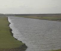
The Chychyklia (Ukrainian: Чичиклія) is a river in Ukraine and a right tributary of the Southern Bug that flows through Odesa Oblast and Mykolaiv Oblast at the border between the Podolian Upland and Black Sea Lowland within the Ukrainian steppe. The river often dries away for up to six months.
It is 156 kilometres (97 mi) long and its basin area is 2,120 square kilometres (819 sq mi).
References
- ^ With frogs instead of roses there is covered once full of water Chychyklia (Жабуринням замість троянд вкрита колись повноводна Чичиклія). Narodna dumka.
- Чичиклея, Great Soviet Encyclopedia
| Black Sea | |
|---|---|
| Bug | |
| Danube | |
| Dnieper (Rapids) | |
| Dniester | |
| Don | |
| Pripyat | |
| San | |
| Sea of Azov | |
| Southern Bug | |
| Syvash | |
This article about a location in Odesa Oblast is a stub. You can help Misplaced Pages by expanding it. |
This article about a location in Mykolaiv Oblast is a stub. You can help Misplaced Pages by expanding it. |
This article related to a river in Ukraine is a stub. You can help Misplaced Pages by expanding it. |