| Sarany Сараны | |
|---|---|
| Urban-type settlement | |
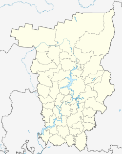
| Location of Sarany | |
  | |
| Coordinates: 58°32′48″N 58°45′41″E / 58.5467°N 58.7614°E / 58.5467; 58.7614 | |
| Country | Russia |
| Federal subject | Perm Krai |
| Administrative district | Gornozavodsky District |
| Founded | 1889 |
| Population | |
| • Total | 1,097 |
| Time zone | UTC+5 (MSK+2 |
| Postal code(s) | 618850 |
| OKTMO ID | 57614405051 |
Sarany (Russian: Сараны) is an urban locality (an urban-type settlement) in Gornozavodsky District of Perm Krai, Russia. Population: 1,097 (2010 Census); 1,255 (2002 Census); 1,351 (1989 Soviet census).
Geologists are aware that Uvarovite was found there in the 20th century.
History
The settlement arose in 1889 due to the discovery of a chromite deposit used in the chemical and ceramic industries. The extraction of chromites started in 1889. Over a century of mining, more than 10 million tonnes of chromite ore were produced.
The settlement has been an urban settlement since June 26, 1940.

References
- ^ Russian Federal State Statistics Service (2011). Всероссийская перепись населения 2010 года. Том 1 [2010 All-Russian Population Census, vol. 1]. Всероссийская перепись населения 2010 года (in Russian). Federal State Statistics Service.
- "Об исчислении времени". Официальный интернет-портал правовой информации (in Russian). June 3, 2011. Retrieved January 19, 2019.
- Почта России. Информационно-вычислительный центр ОАСУ РПО. (Russian Post). Поиск объектов почтовой связи (Postal Objects Search) (in Russian)
- Federal State Statistics Service (May 21, 2004). Численность населения России, субъектов Российской Федерации в составе федеральных округов, районов, городских поселений, сельских населённых пунктов – районных центров и сельских населённых пунктов с населением 3 тысячи и более человек [Population of Russia, Its Federal Districts, Federal Subjects, Districts, Urban Localities, Rural Localities—Administrative Centers, and Rural Localities with Population of Over 3,000] (XLS). Всероссийская перепись населения 2002 года (in Russian).
- Всесоюзная перепись населения 1989 г. Численность наличного населения союзных и автономных республик, автономных областей и округов, краёв, областей, районов, городских поселений и сёл-райцентров [All Union Population Census of 1989: Present Population of Union and Autonomous Republics, Autonomous Oblasts and Okrugs, Krais, Oblasts, Districts, Urban Settlements, and Villages Serving as District Administrative Centers]. Всесоюзная перепись населения 1989 года (in Russian). Институт демографии Национального исследовательского университета: Высшая школа экономики . 1989 – via Demoscope Weekly.
| Administrative divisions of Perm Krai | |||
|---|---|---|---|
| Administrative center: Perm • Rural localities | |||
| Administrative districts |
| ||
| Administrative districts of Komi-Permyak Okrug | |||
| Closed administrative-territorial formations | |||
| Cities and towns (all levels) | |||
| Urban-type settlements | |||
This Perm Krai location article is a stub. You can help Misplaced Pages by expanding it. |