| Maria de la Salut | |
|---|---|
| Municipality | |
 Coat of arms Coat of arms | |
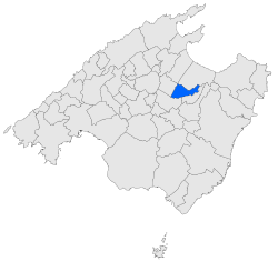
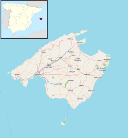
 Location within Mallorca Location within Mallorca | |
   | |
| Coordinates: 39°39′52″N 3°04′29″E / 39.66444°N 3.07472°E / 39.66444; 3.07472 | |
| Country | |
| Autonomous community | |
| Province | Balearic Islands |
| Comarca | Pla de Mallorca |
| Area | |
| • Total | 30.49 km (11.77 sq mi) |
| Elevation | 123 m (404 ft) |
| Population | |
| • Total | 2,143 |
| • Density | 70/km (180/sq mi) |
| Time zone | UTC+1 (CET) |
| • Summer (DST) | UTC+2 (CEST) |
Maria de la Salut (Catalan pronunciation: [məˈɾi.ə ðə lə səˈlut]) is a small town and municipality located in the center of the island in the district of es pla on Majorca and in the northeast of the capital, one of the Balearic Islands, Spain. It borders on the municipalities of Llubí, Santa Margalida, Ariany and Sineu.
History
At the time of the Christian conquest, Maria's lands included the Murūh Islamic district. In the cast, it fell to the part of the Count of Empúries.
The municipality of Maria de la Salut appeared in the nineteenth century when it segregated from Santa Margalida.
They emphasize the "possessions" of Roqueta, Deulosal and Montblanc, as well as other estates and places such as sa Bisbal, Son Gil, es Pujol, es Rafal, Son Perot, es Gassons, sa Font, Son Roig, ses Sors, es Rafal Nou, sa Torreta, Son Niell, Llampí, Son Xigala, Vall d'Aram, Ses Tarragones and Son Bacs.
Economy
Traditionally it is an agricultural town where the extensive herbaceous crops and the ovine cattle ranch stand out; As well as garlic, melons, watermelons and tomatoes (which are often produced in rainfed land); And in marginal areas, the almond trees.
In the last years several companies dedicated to the construction have already proliferated, either construction materials (mainly blockades and other prefabricated ones) as public and civil works.
There have been, and still exist, craftsmen of wood and iron.
They emphasize like other habitual trades, in number those of teachers and professors.
See also
List of monuments and places of interest Maria de la Salut
References
- Municipal Register of Spain 2018. National Statistics Institute.
- National Institute of Statistics of Spain
External links
 Media related to Maria de la Salut at Wikimedia Commons
- Page of the City Council
- Estatistics
- Guia de Mallorca: Maria de la Salut
- Diario de Mallorca Antoni Gelabert Mas
This article about a location in the Balearic Islands is a stub. You can help Misplaced Pages by expanding it. |