
Earthquakes in Russia have occasionally been damaging and deadly.
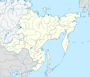
Map
Some of the largest Russian earthquakes since the latter half of the 20th century are the 1958/1963 and 2006/2007 earthquakes in the Kuril Islands near Japan, as well as the 1952/1959 earthquakes in the Kamchatka Peninsula, all of which were ≥ 8.0 M. See also the Kuril–Kamchatka Trench.
Earthquakes
| Date | Region | Mag. | MMI | Deaths | Injuries | Total damage / notes | |
|---|---|---|---|---|---|---|---|
| 2022-07-05 | Kemerovo | 4.4 Mw | 2 | 2 | Deaths due to rockfalls in a mine | ||
| 2020-03-25 | Kuril Islands | 7.5 Mw | V | 1 | Tsunami | ||
| 2017-07-17 | Kamchatka | 7.8 Mw | VII | ||||
| 2013-05-24 | Okhotsk Sea | 8.3 Mw | V | Significant in seismology | |||
| 2011-12-27 | Tuva | 6.6 Mw | VI | Buildings damaged | |||
| 2011-10-14 | Amur | 6.0 Mw | VII | Minor damage/Power outages | |||
| 2008-10-11 | North Caucasus | 5.8 Mw | VIII | 13 | 116 | ||
| 2008-08-27 | Lake Baikal | 6.3 Mw | VIII | Minor damage | |||
| 2007-08-02 | Tatar Strait | 6.2 Mw | VIII | 2 | 12 | Tsunami | |
| 2007-01-13 | Kuril Islands | 8.1 Mw | VI | Tsunami | |||
| 2006-11-15 | Kuril Islands | 8.3 Mw | IV | 1 | Tsunami | ||
| 2006-04-21 | Kamchatka | 7.6 Mw | X | 40 | $55 million | ||
| 2004-09-21 | Kaliningrad | 4.8 Mw | VI | 3 | 17 buildings damaged / Rare event | ||
| 2003-09-27 | Altai Republic | 7.3 Mw | X | 3 | 5 | $10.6–33 million | |
| 2000-08-04 | Sakhalin | 6.8 Mw | VI | 8 | 19,100 displaced | ||
| 1997-12-05 | Kamchatka | 7.7 Mw | VII | ||||
| 1995-05-27 | Sakhalin | 7.0 Ms | IX | 1,989 | 750 | $64.1–300 million | |
| 1994-10-04 | Kuril Islands | 8.3 Mw | 12 | 1000+ | Tsunami | ||
| 1970-05-14 | North Caucasus | 6.7 Mw | VII | 31 | 1,000+ | ||
| 1963-10-20 | Kuril Islands | 7.8 Mw | Tsunami | ||||
| 1963-10-13 | Kuril Islands | 8.5 Mw | IX | Tsunami | |||
| 1959-05-04 | Kamchatka | 8.0 Ms | VIII | 1 | 13 | Tsunami | |
| 1958-11-06 | Kuril Islands | 8.3 Mw | X | Tsunami | |||
| 1952-11-05 | Kamchatka | 9.0 Mw | XI | 2,336 | Earthquake+Tsunami | ||
| 1946-11-02 | Kyrgyzstan, Kazakhstan and Uzbekistan | 7.6 Mw | X | Unknown | Severe damage | ||
| 1923-04-13 | Kamchatka | 6.8 Mw | X | 18 | Tsunami | ||
| 1923-02-03 | Kamchatka | 8.4 Ms | XI | 3 | |||
| 1918-09-07 | Kuril Islands | 8.1 Mw | 23 | 17 | Tsunami | ||
| 1911-01-03 | Kazakhstan, Kyrgyzstan | 7.7 Mw | X | 452 | Severe damage | ||
| 1907-10-21 | Uzbekistan, Tajikistan | 7.4 Ms | IX | 12,000–15,000 | |||
| 1902-08-22 | Kyrgyzstan, China | 7.7 Mw | XI | 2,500-20,000 | Severe damage | ||
| Note: The inclusion criteria for adding events are based on WikiProject Earthquakes' notability guideline that was developed for stand alone articles. The principles described also apply to lists. In summary, only damaging, injurious, or deadly events should be recorded. | |||||||
See also
- Geology of Russia
- Kamchatka earthquakes
- List of tectonic plate interactions
- List of volcanoes in Russia
References
- "M 4.4 – SOUTHWESTERN SIBERIA, RUSSIA – 2022-07-05 08:47:26 UTC". emsc-csem.org.
- "в кузбассе поднято на поверхность тело погибшего на "распадской" шахтёра" [In Kuzbass, the body of a miner who died on the "Raspadskaya" was raised to the surface]. Tsargrad TV (in Russian). 6 July 2022. Retrieved 6 July 2022.
- Samsonov, Mikhail (5 July 2022). "В Кузбассе погибли два горняка в шахте Распадская-Коксова" [In Kuzbass, two miners died in the Raspadskaya-Koksovaya mine]. URA (in Russian). Retrieved 6 July 2022.
- "M 7.5 – 221 km SSE of Severo-Kuril'sk, Russia". United States Geological Survey. Retrieved 2020-04-11.
- "В России – угроза цунами после мощного землетрясения: людей эвакуируют" [In Russia – the threat of a tsunami after a powerful earthquake: people are evacuated]. Glavred.info (in Russian). 2020-03-25. Retrieved 2022-05-16.
- "M 6.6 – 45 km NNE of Saryg-Sep, Russia". United States Geological Survey.
- "M 6.0 – 8 km ESE of Takhtamygda, Russia". United States Geological Survey.
- "Very strong shallow dangerous earthquake in Amur area, Russia – many aftershocks are reported". earthquake-report.com. Archived from the original on October 25, 2011. Retrieved May 4, 2022.
- "M 6.3 – Lake Baykal region, Russia". United States Geological Survey.
- "M 6.2 – Tatar Strait, Russia". United States Geological Survey.
- "M 4.8 – 3 km SSW of Yantarnyy, Russia". United States Geological Survey.
- "M 6.8 – 35 km SSE of Uglegorsk, Russia". United States Geological Survey.
- "M 6.7 – Caucasus region, Russia". United States Geological Survey. Retrieved July 3, 2019.
- "M 8.3 – Kuril Islands". United States Geological Survey. Retrieved March 12, 2018.
- "M 6.8 – near the east coast of the Kamchatka Peninsula, Russia". United States Geological Survey. Retrieved July 3, 2019.
- National Geophysical Data Center / World Data Service: NCEI/WDS Global Historical Tsunami Database. NOAA National Centers for Environmental Information. "Tsunami Event: KAMCHATKA". NOAA National Centers for Environmental Information. doi:10.7289/V5PN93H7. Retrieved March 20, 2024.
- "M 8.1 – Kuril Islands". United States Geological Survey. Retrieved July 3, 2019.
| List of earthquakes in Europe | |
|---|---|
| Sovereign states |
|
| States with limited recognition | |
| Dependencies and other entities | |