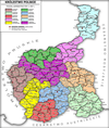
| Kalisz GovernorateКалишская губерния Gubernia kaliska | |||||||||
|---|---|---|---|---|---|---|---|---|---|
| Governorate of Congress Poland | |||||||||
| 1867–1915 | |||||||||
 Coat of arms
| |||||||||
 Location in the Russian Empire | |||||||||
| Capital | Kalish | ||||||||
| Area | |||||||||
| • | 11,336.6 km (4,377.1 sq mi) | ||||||||
| Population | |||||||||
| • 1897 | 840,597 | ||||||||
| History | |||||||||
| • Established | 1867 | ||||||||
| • Disestablished | 1915 | ||||||||
| |||||||||
Kalisz Governorate was an administrative-territorial unit (guberniya) of Congress Poland of the Russian Empire.
History
It was created in 1837 from the Kalisz Voivodeship, and had the same borders and centre (Kalisz) as the voivodeship.
The Reform of 1844 merged the governorate into the larger Warsaw Governorate, until the 1867 reform which reversed those changes and recreated the Kalisz Governorate.
Language
| Language | Total | Percentage | Males | Females |
|---|---|---|---|---|
| Polish | 705 400 | 83.91% | 345 348 | 360 052 |
| Yiddish | 64 193 | 7.63% | 30 941 | 33 252 |
| German | 61 482 | 7.31% | 30 289 | 31 193 |
| Russian | 7 451 | 0.88% | 5 985 | 1 466 |
| Ukrainian | 1 429 | 0.16% | 1 391 | 38 |
| Other | 618 | <0.1% | 521 | 97 |
| No native language named | 22 | <0.01% | 11 | 11 |
| Total | 840 597 | 100% | 414 488 | 426 109 |
Notes
References
- "Первая всеобщая перепись населения Российской Империи 1897 г." [The first general census of the population of the Russian Empire in 1897]. Demoscope Weekly (in Russian).
- Language Statistics of 1897 Archived 2011-06-22 at the Wayback Machine (in Russian)
- Languages, number of speakers which in all gubernia were less than 1000
External links
- (in Polish) Gubernia kaliska w Słowniku geograficznym Królestwa Polskiego i innych krajów słowiańskich, Tom III (Haag — Kępy) z 1882 r.
- Geographical Dictionary of the Kingdom of Poland
| 1816–1837 voivodeships |  | |
|---|---|---|
| 1837–1844 governorates | ||
| 1844–1867 governorates | ||
| 1867–1914 governorates | ||
51°45′50″N 18°05′04″E / 51.763799°N 18.084363°E / 51.763799; 18.084363
Categories: