| This article needs additional citations for verification. Please help improve this article by adding citations to reliable sources. Unsourced material may be challenged and removed. Find sources: "Dzyarzhynskaya Hara" – news · newspapers · books · scholar · JSTOR (February 2013) (Learn how and when to remove this message) |
| Dzyarzhynskaya Hara | |
|---|---|
 | |
| Highest point | |
| Elevation | 345 m (1,132 ft) |
| Listing | Country high point |
| Coordinates | 53°50′55″N 27°3′55″E / 53.84861°N 27.06528°E / 53.84861; 27.06528 |
| Geography | |
 | |
| Location | Belarus |
| Geology | |
| Mountain type | Hill |
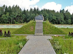
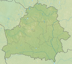
Dzyarzhynskaya Hara (Belarusian: Дзяржынская гара, romanized: Dziaržynskaja hara, [dzʲarˈʐɨnskaja]) is the highest point in Belarus. The hill is 345 meters (1,130 ft) above sea level and is located west of the capital Minsk, near Dzyarzhynsk, in the village of Skirmantava. The original name of the hill was Svyataya hara (Belarusian: Святая гара, lit. 'holy mountain'). In 1958, the hill was renamed Dzyarzhynskaya hara, in honour of Soviet revolutionary and politician Felix Dzerzhinsky, the founder of the OGPU.
See also
- Geography of Belarus
- Extreme points of Belarus
- List of highest points of European countries
- List of elevation extremes by country
References
- "Dzyarzhynskaya Hara" Archived 2013-12-20 at the Wayback Machine Peakery.com. Retrieved 2013-02-18.
- "Coordinates of the extreme points of the state frontier. Main Geographic Characteristics of the Republic of Belarus". Land of Ancestors. 2011. Retrieved 9 September 2013.
External links
This Belarus location article is a stub. You can help Misplaced Pages by expanding it. |