| Varser Վարսեր | |
|---|---|
 A view of Varser A view of Varser | |
  | |
| Coordinates: 40°33′16″N 44°54′29″E / 40.55444°N 44.90806°E / 40.55444; 44.90806 | |
| Country | Armenia |
| Province | Gegharkunik |
| Municipality | Sevan |
| Elevation | 1,917 m (6,289 ft) |
| Population | |
| • Total | 1,901 |
| Time zone | UTC+4 (AMT) |
| Postal code | 1515 |
| Varser at GEOnet Names Server | |
Varser (Armenian: Վարսեր) is a village in the Sevan Municipality of the Gegharkunik Province of Armenia.
Etymology
The name Varser is derived from a root word meaning "hair". According to popular folklore, this refers to a girl who drowned in Lake Sevan, after which her long hair spread out across the water. The village was also previously known as Chirchir and Chrchr until 1946.
History
The village is first mentioned in the 9th century as a gift of Ashot II Bagratuni to an "Apostles' Church". Most of the Armenians in the village are descendants of migrants from Bitlis and Maku in Western Armenia, today located in southeastern Turkey and northwestern Iran, respectively.
Gallery
-
 Church in Varser
-
 WWII monument
-
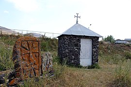
 Khachkars in Varser
-
 Chapel near the village cemetery
-
 Tsaghkavank
-
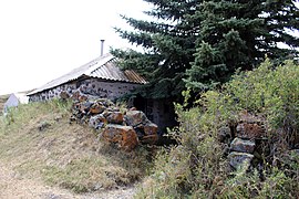
 Church ruins
-
 Varser cemetery
References
- Statistical Committee of Armenia. "The results of the 2011 Population Census of Armenia" (PDF).
- ^ Kiesling, Brady; Kojian, Raffi (2005). Rediscovering Armenia: Guide (2nd ed.). Yerevan: Matit Graphic Design Studio. p. 74. ISBN 99941-0-121-8.
External links
- Report of the results of the 2001 Armenian Census, Statistical Committee of Armenia
- Kiesling, Brady (June 2000). Rediscovering Armenia: An Archaeological/Touristic Gazetteer and Map Set for the Historical Monuments of Armenia (PDF). Archived (PDF) from the original on 6 November 2021.
This article about a location in Gegharkunik Province, Armenia is a stub. You can help Misplaced Pages by expanding it. |
