Misplaced Pages

Tylers Common

Article snapshot taken from Wikipedia with creative commons attribution-sharealike license. Give it a read and then ask your questions in the chat. We can research this topic together.
Tylers Common
Tylers Common
TypeCommon land
Coordinates51°35′31″N 0°15′32″E / 51.592°N 0.259°E / 51.592; 0.259
Area79.2 acres (0.321 km)
Operated byHavering London Borough Council
OpenAll year

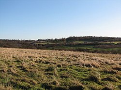
Tylers Common, also known as Upminster Common, is common land in the London Borough of Havering. It is one of the largest areas of common land in Greater London, with 32.06 hectares (79.2 acres) of protected commons.

References

  1. "Common Land and the Commons Act 2006". Defra. 13 November 2012. Retrieved 3 February 2013.
London Borough of Havering
Districts Coat of arms of Havering

Location of the London Borough of Havering in Greater London
Attractions
Major retail
Places of worship
Parks and open spaces
Constituencies
Tube and rail stations
Other topics
Parks and open spaces in London
Royal parks
Large urban parks
Country parks
Commons
Village greens
Marshes and wetlands
Woodland
House gardens
Entry-fee charging
Community gardens
Parks and open spaces by London borough
Categories: