| Tanga Island | |
|---|---|
| IUCN category II (national park) | |
 Island within Tanga bay Island within Tanga bay | |
 | |
| Location | Tanga Region, Tanga District |
| Nearest city | Tanga |
| Coordinates | 5°3′20.29″S 39°6′27.11″E / 5.0556361°S 39.1075306°E / -5.0556361; 39.1075306 |
| Length | 1.0 km (0.62 mi) |
| Width | 0.2 km (0.12 mi) |
| Established | 2010 |
| Governing body | Marine Parks & Reserves Authority (Tanzania) |
| Website | Tanga Coelacanth Marine Park |
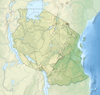
Tanga Island known during German East Africa as Toten Island in old colonial maps (Swahili Toten, adapted from German Toteninsel, meaning "Island of the Dead") is a small uninhabited and protected island situated north of the city of Tanga's harbour on Tanga Bay in Tanga Region, Tanzania. It is within the Tanga Bay. The island is located entirely with the Tanga Coelacanth Marine Park (TCMP). The island is administered by Tanzania Marine Parks and Reserves.
Historical Site
The island is a historical site that contains ruins of two Medieval Swahili mosques and tombs. The current name comes from the German word for "dead bodies" alluding to the numerous graves on the island. Until 1854 Toten Island was still inhabited by people. In 1884 the remaining people moved to what is present day Tanga city.
See also
References
- Cooke, H. J. "The coastal geomorphology of Tanga, Tanzania." Geographical Review (1974): 517-535.
- "Marine Parks and Reserves Tanzania : Tanga Coelacanth Marine Park". Marineparks.go.tz. Retrieved 13 February 2022.
- Fraser, Catherine C. "Visual Clues to Interpreting Strindberg's" Spöksonaten"." Scandinavian Studies 63.3 (1991): 281-292.
- James De Vere Allen. “Swahili Architecture in the Later Middle Ages.” African Arts, vol. 7, no. 2, UCLA James S. Coleman African Studies Center, 1974, pp. 42–84, https://doi.org/10.2307/3334723.
- Tanzania By Jens Finke Published by Rough Guides, 2003 ISBN 1-85828-783-9, ISBN 978-1-85828-783-6, p. 169
- http://www.urithi.org/index.php?option=com_content&task=view&id=2&Itemid=1
| Tanga District | |
|---|---|
| Capital: Chumbageni | |
| Wards | |
| Native Peoples | |
| National Historic Sites | |
| National Parks and Forest Reserves | |
| Islands | |
| Rivers and Lakes | |
| Landmarks of Tanga | |
| Heritage Monuments of Tanga |
|
| Tanga Region | |
|---|---|
| Capital: Tanga | |
| Districts | |
| Native Peoples | |
| National Historic Sites |
|
| Islands | |
| Rivers and Lakes | |
| Major Cities and Towns | |
| National Parks and Reserves |
|
| Landmarks of Tanga |
|
| Heritage Monuments of Tanga |
|
This Tanga Region location article is a stub. You can help Misplaced Pages by expanding it. |
- IUCN Category II
- Islands of Tanzania
- Coastal islands of Tanzania
- Islands of Tanga Region
- Uninhabited islands of Tanzania
- Geography of Tanga Region
- Swahili people
- Swahili city-states
- Swahili culture
- Tanga, Tanzania
- National Historic Sites in Tanga Region
- National Historic Sites in Tanzania
- Archaeological sites in Tanzania
- Tanzania geography stubs