| Ordacsehi Čeja (in Croatian) | |
|---|---|
| Village | |
 Coat of arms Coat of arms | |
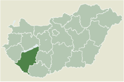
 Location of Somogy county in Hungary Location of Somogy county in Hungary | |
 | |
| Coordinates: 46°44′31″N 17°37′24″E / 46.74181°N 17.62332°E / 46.74181; 17.62332 | |
| Country | |
| Region | Southern Transdanubia |
| County | Somogy |
| District | Fonyód |
| RC Diocese | Kaposvár |
| Area | |
| • Total | 22.56 km (8.71 sq mi) |
| Population | |
| • Total | 761 |
| Demonym | ordacsehi |
| Time zone | UTC+1 (CET) |
| • Summer (DST) | UTC+2 (CEST) |
| Postal code | 8635 |
| Area code | (+36) 85 |
| Patron Saint | Wendelin of Trier |
| Motorways | M7 |
| Distance from Budapest | 147 km (91 mi) Northeast |
| NUTS 3 code | HU232 |
| MP | József Attila Móring (KDNP) |
| Website | Ordacsehi Online |
Ordacsehi (Croatian: Čeja) is a village in Somogy county, Hungary.
The settlement is part of the Balatonboglár wine region.
History
According to László Szita the settlement was completely Hungarian in the 18th century.
External links
References
- Ordacsehi, KSH
- A Balatonboglári borvidék hegyközségi tanácsának alapszabálya (PDF)
- László Szita : Somogy megyei nemzetiségek településtörténete a XVIII-XIX. században - Somogyi Almanach 52. (Kaposvár, 1993)
| Ordacsehi's neighbours | ||||||||||||||||
|---|---|---|---|---|---|---|---|---|---|---|---|---|---|---|---|---|
| ||||||||||||||||
| Towns and villages of Fonyód District | ||
|---|---|---|
| Towns (4) |
| |
| Villages (17) | ||
This Somogy county location article is a stub. You can help Misplaced Pages by expanding it. |

