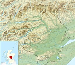
Freshwater loch
| Monk Myre | |
|---|---|
 The west end of the little lochan. The west end of the little lochan. | |
 | |
| Location | NO20954273 |
| Coordinates | 56°34′11″N 3°17′21″W / 56.56969°N 3.289185°W / 56.56969; -3.289185 |
| Type | freshwater loch |
| Max. length | 0.8 km (0.50 mi) |
| Max. width | 0.22 km (0.14 mi) |
| Surface area | 5 ha (12 acres) |
| Average depth | 5 ft (1.5 m) |
| Max. depth | 12 ft (3.7 m) |
| Water volume | 5,552,000 cu ft (157,200 m) |
| Shore length | 1 km (0.62 mi) |
| Surface elevation | 46 m (151 ft) |
| Max. temperature | 55.8 °F (13.2 °C) |
| Min. temperature | 55.8 °F (13.2 °C) |
| Islands | 0 |
| Shore length is not a well-defined measure. | |
Monk Myre is a small shallow freshwater lochan and is located 2.5 miles southeast of Blairgowrie in Perth and Kinross.
Geography
Monk Myre is of glacial origin and is formed as a type of geographic formation known as a kettle that has partially silted up. The loch is a designated Site of Special Scientific Interest (SSSI), as well as forming part of a Special Area of Conservation.
See also
References
- ^ John, Murray; Lawrence, Pullar. Bathymetrical Survey of the Fresh-Water Lochs of Scotland, 1897-1909 Lochs of the Tay Basin Volume II - Monk Myre. National Library of Scotland. p. 111. Retrieved 28 September 2019.
 This article incorporates text from this source, which is in the public domain.
- ^ "Monk Myre". Centre for Ecology and Hydrology. Scotland and Northern Ireland Forum for Environmental Research (SNIFFER). Retrieved 28 September 2019.
- Gittings, Bruce; Munro, David. "Monk Myre". The Gazetteer for Scotland. School of GeoSciences, University of Edinburgh and The Royal Scottish Geographical Society. Retrieved 28 September 2019.
- Dunkeld - Blairgowrie Lochs, Joint Nature Conservation Committee