| This article may require cleanup to meet Misplaced Pages's quality standards. The specific problem is: grammar and prose. Please help improve this article if you can. (December 2020) (Learn how and when to remove this message) |
| Jhuruli | |
|---|---|
| Village | |
  | |
| Coordinates: 22°36′13″N 88°47′54″E / 22.603550°N 88.798241°E / 22.603550; 88.798241 | |
| Country | |
| State | West Bengal |
| District | North 24 Parganas district |
| CD Block | Basirhat II |
| Government | |
| • Gram Members (Village Members) | Nasima Khatun, Sahanur Dafadar |
| • M.P | (Haji Nurul Islam 2024 Lok Sabha) |
| • M.L.A | (Rafikul Islam Mondal) |
| Population | |
| • Total | 2,967 |
| Languages | |
| • Official | Bengali |
| Time zone | UTC5:30 (IST) |
| PIN | 743456 |
| Telephone code | 03217 |
| ISO 3166 code | IN-WB |
| Vehicle registration | WB26 |
| Lok Sabha constituency | Basirhat |
| Vidhan Sabha constituency | Basirhat Uttar |
| Website | north24parganas |
Jhuruli is a village in Basirhat II CD Block in Basirhat subdivision of North 24 Parganas district in the Indian state of West Bengal.
Geography
Jhuruli is situated in the Ganges Brahmaputra delta of West Bengal, about 30 km from the Bangladesh border and 50 km from Kolkata, capital of the West Bengal. A high tension electricity transmission line of 11 kv from Harishpur, Basirhat has been routed through the village road.
Weather
The weather in Jhuruli is similar to that elsewhere in West Bengal, with a tropical climate, specifically a tropical wet and dry climate(Aw) under the Köppen climate classification, with seven months of dryness and peak of rains in July. Humidity is always on the higher side, but not in winter. The cooler season from December to February is followed by the summer season from March to June. The period from June to about the end of September constitutes the south-west monsoon season, and October and November form the post-monsoon season. Between June and September, the south west monsoon rains lash the village. Pre-monsoon showers are received in May. Occasionally, north-east monsoon showers occur in October and November.
The maximum annual rainfall ever recorded was 1500 mm for every year. The highest rainfall recorded in a single day was 850 mm. The average total annual rainfall is 1500 mm. The average annual temperature is 32 °C, and the average maximum temperature is 35 °C, while the average minimum temperature is 28 °C. In the summer the temperature is up to 35 °C, but in winter it drops to approximately 10 °C. Annual rainfall is about 1 500 mm.
Groundwater

The groundwater is contaminated by arsenic in this village but solutions for purification have been found. The Government of West Bengal has dug up tube wells in several places here and water pump houses.
The North 24 Parganas district has been identified as one of the areas where ground water is affected by arsenic contamination.
Demographics
As of 2011 Indian census, Jhuruli had a population of 2,967: 1,545 male and 1,422 female. It has an average literacy rate of 75.02%, higher than the national average of 74.04%.
Economy
Many villagers work in the fishery business. Another local business is transportation of fabric, fish and other products to Kolkata.
Village parts

The village consists of six parts:
- Biswas Para (Bengali: বিশ্বাস পাড়া)
- Majher para(Bengali: মাঝের পাড়া)
- Molla para (Bengali:মোল্লা পাড়া)
- Shekh para (Bengali:শেখ পাড়া)
- Purba para (Bengali:পূর্ব পাড়া)
- Dakshin para (Bengali: দক্ষিণ পাড়া)
Politics
Jhuruli has some political parties which work under Lok Sabha, Rajya Sabha and Vidhan Sabha. The election commission elected members for villages. Here are some political parties All India Trinamool Congress, Communist Party of India (Marxist), PDCI Party, Indian National Congress. The present village members are Nasima Khatun and Sahanur Dafadar for AITMC in 2023 and Member of Parliament is Haji Nurul Islam and MLA is Rafikul Islam Mondal
Political members of 2003-2028
| Political members | Period | Booth No. |
|---|---|---|
| Abul Kalam Azad | 2003–2008 | 8 |
| Shekh Anarul Islam | 2003-2008 | 9 |
| Abdul Rouf Mondal | 2008-2013 | 8 |
| Rofikul Mondal | 2008-2013 | 9 |
| Nurali Mondal | 2013-2018 | 8 |
| Rofikul Mondal | 2013-2018 | 9 |
| Mostafa Dafadar | 2018-2023 | 8 |
| Khadija Khatun | 2018-2023 | 9 |
| Nasima Khatun | 2023-2028 | 8 |
| Sahanur Dafadar | 2023-2028 | 9 |
| Source: Gram panchayat election. | ||
Education
The educational percentage here is about 40% but gradually increasing.

Jhuruli Adarsha Vidyapith and Jhuruli Jr Basic School located in this village are a grade school running up to grade class 10 and a primary school up to grade class 4 respectively
Schools in the village
- Jhuruli Adarsha Vidyapith
- Jhuruli Jr Basic School
- Jhuruli Uttar para Sid Ami
Rural structure

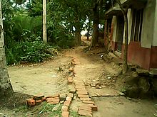
In Jhuruli all boundaries which bounded the village are seemed to be specific. The area cover mostly with small parts of the village. The edge of the village which also stated round the village is watery called sometime "Jolkor" means water tax and some time Plunge means general use free water. Jolkor is projected with fishery which is the main economic point of the village. The roads about here are narrow,they are seemed as turn now to the right and now to the left. It is said that the village faces always the cool air of water, basically the cool air of Jolkor that bounds the village.
Infrastructure
The sovereignty of society with political and social is deep-rooted here that graduated by government's infrastructure. The political and social organizations are abided of government's rule.
| |||||||||||||||||||||||||||||||||||||||||||||||||||||||
| Village information with code of census and India village directory | ||
| Category | Description | Code |
|---|---|---|
| Jhuruli | Code of census,2011 | 1736500 |
| State | The state of Jhuruli is West Bengal | 19 |
| District | Jhuruli falls under North 24 Parganas in W.B | 337C.D |
| Block | Jhuruli → Basirthat ll (Community development block) | 02330 |
| Source: Census of India | ||


Transport


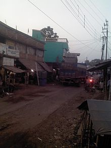
In Jhuruli the transport has developed gradually. There is bus transport, which was begun in 2008 with about 40 buses. The DN 38 bus route started from Taranipur to Malancha through Basirhat town, Champapukur, Kholapota. It stopped unexpectedly in 2013 due to the road's bad condition. Other transport systems include auto rickshaw, motorcycle, motor van, Maruti Suzuki, taxi and bicycle.
The goods which are transported to various town and other part of India are: fish, crayfish, shrimp, whitefish, big guns, ready made fabric, textiles, garments (shirt, pants, gown, skirts, etc.)
Healthcare

There is a healthcare centre, not only for this village but also for nearby villagers.
Culture
The culture here is basically rural as in other villages of India as opposed to western norms which the west colonial has imposed upon Indian population. People wear basically Dhuti, Lungi, Pajama, Shirt, trousers and speak in a very dialectic sort. They sometimes speak Hindi, but most of the time Bengali. English is frequently used.
Sports

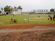
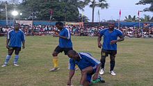
Here sport means life of the village. Every year during October–November holds a knock-out football match of 16 teams organizes by Jhuruli Abahani Krira Chakra in the ball field that is the major point of this village. Apart from that, there are daily football match played in afternoon along with cricket and other sports played here.
References
- "MLAs of North 24 parganas". Archived from the original on 18 January 2014. Retrieved 2 June 2014.
- "Groundwater Arsenic contamination in West Bengal-India (19 years study )". Groundwater arsenic contamination status of North 24-Parganas district, one of the nine arsenic affected districts of West Bengal-India. SOES. Archived from the original on 27 September 2007. Retrieved 24 August 2007.
- "Primary census abstract data". Census of India. Retrieved 22 February 2014. (For villages, select "rural" radio button, then select state, district and sub-district. A drop down list of villages well appear. Select the village.)
- "PVT.JHURULI UTTAR PARA SID AMI, BASIRHAT - II". www.schoolsworld.in.
External links
| North 24 Parganas district topics | |||||||||
|---|---|---|---|---|---|---|---|---|---|
| General |
| ||||||||
| Subdivisions | |||||||||
| Municipalities | |||||||||
| Community development blocks |
| ||||||||
| Rivers | |||||||||
| Transport |
| ||||||||
| Railway stations | |||||||||
| Institutes of higher learning | |||||||||
| Lok Sabha constituencies |
| ||||||||
| Vidhan Sabha constituencies |
| ||||||||
| Former Vidhan Sabha constituencies | |||||||||
| See also | |||||||||


