Human settlement in Scotland
| Greengairs | |
|---|---|
 Road through Greengairs Road through Greengairs | |
 | |
| Population | 520 (2022) |
| Council area | |
| Country | Scotland |
| Sovereign state | United Kingdom |
| Police | Scotland |
| Fire | Scottish |
| Ambulance | Scottish |
| 55°54′50″N 3°56′30″W / 55.913978°N 3.941800°W / 55.913978; -3.941800 | |
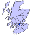
Greengairs is a village in North Lanarkshire, Scotland. Greengairs is shown on a map by Roy c.1754 under the name of Green Geirs. In toponymy the name means "green strips of grass". Lying 3 miles (5 km) southeast of Cumbernauld and 3 miles (5 km) north east of Airdrie, the village consists mainly of local authority housing. Between them Greengairs and Wattston have about 1,190 residents.
It developed in the nineteenth century due to increased coal mining and quarrying. Ironstone was first mined by the Summerlee Iron Company in the 1840s. It was in the parish of New Monkland or East Monkland. It also historically had its own school; the teachers had a house but no salary. The village was badly affected by the Stanrigg Mining Disaster where, in July 1918, a collapse led to the deaths of 19 miners, 6 of whom came from Greengairs.
Greengairs power station opened in 1996, and is powered by methane produced by biodegrading materials from a large landfill site developed since 1990 in former open cast workings situated to the south of the village. Greengairs is the largest landfill site in Scotland, handling waste from Glasgow and Edinburgh. Greengairs has 6000m of pipes with biogas fed by 90 gas wells.
References
- "Mid-2020 Population Estimates for Settlements and Localities in Scotland". National Records of Scotland. 31 March 2022. Retrieved 31 March 2022.
- "OS 25 inch, 1892-1905". National Library of Scotland. Ordnance Survey. Retrieved 9 June 2017.
- "Roy's map of the Lowlands". National Library of Scotland. Retrieved 3 January 2018.
- Drummond, Peter, John (2014). An analysis of toponyms and toponymic patterns in eight parishes of the upper Kelvin basin (PDF). Glasgow: Glasgow University. p. 350. Retrieved 3 July 2017.
{{cite book}}: CS1 maint: multiple names: authors list (link) - "Estimated population of localities by broad age groups, mid-2012" (PDF). Retrieved 3 January 2018.
- "Airdrie Villages". Monklands Memories. Retrieved 3 January 2018.
- Begg, James (1845). The new statistical account of Scotland (Vol 6 ed.). Edinburgh and London: William Blackwood and Sons. pp. 246–247. Retrieved 3 January 2018.
- "OS 25 inch, 1892-1905". National Library of Scotland. Ordnance Survey. Retrieved 9 June 2017.
- "Stanrigg 9th July 1918". Scottish Mining Website. Retrieved 3 January 2018.
- "Greengairs". Gazetteer for Scotland. Retrieved 22 December 2012.
- "Biomass Energy in Scotland". Renewable Energy In Scotland. Scots Renewables. Retrieved 8 January 2018.
- "Greengairs; Scotland". Biomass Case Studies. University of Strathclyde (Energy Systems Research Unit). Retrieved 8 January 2018.
