Human settlement in Scotland
| Glenmavis | |
|---|---|
 New Monkland parish church, known locally as "The Auld Grey Kirk on the Hill" New Monkland parish church, known locally as "The Auld Grey Kirk on the Hill" | |
 | |
| Population | 2,200 (2022) |
| Council area | |
| Country | Scotland |
| Sovereign state | United Kingdom |
| Police | Scotland |
| Fire | Scottish |
| Ambulance | Scottish |
| 55°53′07″N 3°59′54″W / 55.8853°N 3.9983°W / 55.8853; -3.9983 | |
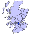
Glenmavis is a village in the North Lanarkshire area of Scotland. It is about two miles (three kilometres) northwest of Airdrie on the B802 road. It has a population of around 2,200 (2022)
Etymology
The etymology of the name is ‘glen of the song-thrush’.
History


Strictly speaking, the village now known as Glenmavis consists of what was once two separate communities. These built up close to the earlier Rochsoles House which is found on Timothy Pont's map. To the east of the church was the village of New Monkland, whereas the newer community to the West was Glenmavis. However, the two effectively merged after World War II. The issue is further confused by the fact that the wider community (including what was once a small hamlet called Arderyth which became Airdrie) was also known as New Monkland. It is for this reason that the school is New Monkland Primary. The school was founded by the Kirk Session of New Monkland (then East Monkland) Church in 1691.
New Monkland Cemetery had for many years two distinct parts. The nearest Condorrat Road was for those from Airdrie while the more eastern part (known as the Landward Cemetery) was for those from the rural area. An oddity of the cemetery is that within it there is another cemetery which was originally in Chapel Street, Airdre. The remains were disinterred and reburied along with the headstones many years ago and there was a heavy chain round that area. From the church gate the island of Arran is sometimes visible on a fine day. There was a castle at Rochsoles Park, followed by a mansion, now demolished, apart from the stables. Formerly a pit village, there are no longer any active coal mines in the area. A blacksmith, a vintner and a wright worked in the village in 1837.
There is a major liquefied natural gas (LNG) storage depot to the north of the village. In 1992 the gas plant was modified by the installation of a Solexol treatment plant. The main contractor for the mechanical installation was Motherwell Bridge Projects Limited and the electrical contractor was Balfour Kilpatrick. The skyline was changed in 1992 with the installation of the main process column "D121". The modifications also included upgrade of the "cold box" plants that are required for the liquification process. These plants are fabricated from aluminium piping and the welding on these plants proved challenging in the early stage of pipe fabrication. All shop piping was fabricated by MB Services in their facility on Ladywell Road, Motherwell.
Notable residents

- Graeme Armstrong, writer
- John Carmichael, recipient of the Victoria Cross (V.C.)
- Dorothea Gerard (1855-1915), novelist
See also
Notes
- "Glenmavis". Monklands Memories. Retrieved 28 February 2018.
- ^ "Mid-2020 Population Estimates for Settlements and Localities in Scotland". National Records of Scotland. 31 March 2022. Retrieved 31 March 2022.
- Drummond, Peter, John (2014). An analysis of toponyms and toponymic patterns in eight parishes of the upper Kelvin basin (PDF). Glasgow: Glasgow University. p. 348. Retrieved 3 July 2017.
{{cite book}}: CS1 maint: multiple names: authors list (link) - Blaeu, Joan. "Glottiana Praefectura Inferior". National Library of Scotland. Retrieved 30 December 2017.
- "Ruchsolis on Pont 34". Maps of Scotland. Timothy Pont (16th century). Retrieved 31 December 2017.
- Historic Environment Scotland. "Rochsoles House (202632)". Canmore. Retrieved 28 February 2018.
- "OS 25 inch, 1892-1905". National Library of Scotland. Ordnance Survey. Retrieved 9 June 2017.
- Pigot and Co.'s national commercial directory for the whole of Scotland and of the Isle of Man ... to which are added, classified directories of ... Manchester, Liverpool, Leeds, etc. London. 1837. pp. 524–526. Retrieved 28 February 2018.
External links
 Media related to Glenmavis at Wikimedia Commons
- Airdrie Museum
- Geograph image of New Monkland Cemetery, Glenmavis
