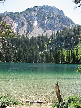
| Fairy Lake | |
|---|---|
 | |
  | |
| Location | Gallatin County, Montana |
| Coordinates | 45°54′16″N 110°57′32″W / 45.9044°N 110.9588°W / 45.9044; -110.9588 |
| Type | Lake |
| Primary inflows | Sacagawea Peak |
| Basin countries | United States |
| Surface elevation | 7,556 ft (2,303 m) |
Fairy Lake is a lake in Gallatin County, Montana at the base of Sacagawea Peak, a part of the Bridger mountains in south central Montana. It is located within the northwestern section of the Gallatin National Forest and sits at an elevation of 7,557 ft (2,303 m).
References
External links
- Montana Fish, Wildlife, and Parks page on Fairy Lake Archived 2009-12-20 at the Wayback Machine
This Gallatin County, Montana state location article is a stub. You can help Misplaced Pages by expanding it. |