| Artenara | |
|---|---|
| Municipality | |
 Flag Flag Coat of arms Coat of arms | |
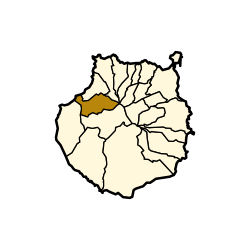
 Municipal location in Gran Canaria Municipal location in Gran Canaria | |
   | |
| Coordinates: 28°1′N 15°39′W / 28.017°N 15.650°W / 28.017; -15.650 | |
| Country | |
| Autonomous Region | Canary Islands |
| Province | Las Palmas |
| Island | Gran Canaria |
| Area | |
| • Total | 66.70 km (25.75 sq mi) |
| Elevation | 1,270 m (4,170 ft) |
| Population | |
| • Total | 1,090 |
| • Density | 16/km (42/sq mi) |
| Time zone | UTC+0 (GMT) |
| Climate | Csb |
Artenara is a village and a Spanish municipality in the western part of the island of Gran Canaria in the Las Palmas province in the Canary Islands.
The village of Artenara is situated in the mountains, 24 km (15 mi) south-west of Las Palmas.
Its population is 1,198 (2013), and the area is 66.70 km (25.75 sq mi). Artenara is the smallest municipality of Gran Canaria in population.
Population
| Year | Population |
|---|---|
| 1991 | 1,104 |
| 1996 | 1,250 |
| 2001 | 1,319 |
| 2002 | 1,394 |
| 2003 | 1,357 |
| 2004 | 1,468 |
| 2013 | 1,198 |
See also
References
- ^ Instituto Canario de Estadística, area
- Municipal Register of Spain 2018. National Statistics Institute.
- Instituto Canario de Estadística, population
External links
| Places adjacent to Artenara | ||||||||||||||||
|---|---|---|---|---|---|---|---|---|---|---|---|---|---|---|---|---|
| ||||||||||||||||
| Gran Canaria | |||||||||
|---|---|---|---|---|---|---|---|---|---|
| Governance |   | ||||||||
| Municipalities | |||||||||
| History | |||||||||
| Nature | |||||||||
| Landmarks and attractions |
| ||||||||
| Transport |
| ||||||||
| Sport | |||||||||
| Education and science | |||||||||
| Municipalities in the province of Las Palmas | ||
|---|---|---|
| Gran Canaria | ||
| Lanzarote | ||
| Fuerteventura | ||